


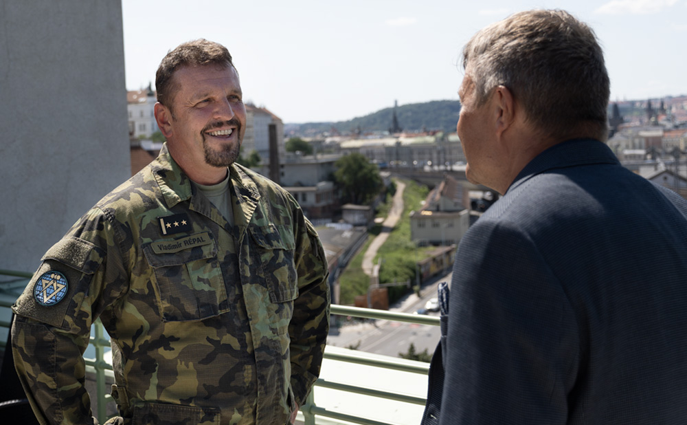
Colonel Vladimír Répal: Personally, I believe that a soldier will always need an analogue map
The Military Geographical and Hydrometeorological Office of General Josef Churavý is a military facility with special military-expert activities, mainly in the areas of geographical security, hydrometeorological security, global navigation and satellite systems, logistic supply of geographical products of the Ministry of Defence and last but not least with its own training and preparation in the field of geographical and hydrometeorological services of the Czech Armed Forces. Geographical security covers a range of activities, including data collection, updating databases or updating existing digital mapping resources and their distribution. This is not only from the Czech Republic, but also from abroad. The Office also includes the management of geodatabases and their updating. Together with its strategic partner, the Czech Geodetic and Cadastral Office, the Military Geographic and Hydrometeorological Office participates in aerial surveying of the territory of the Czech Republic. In the field of hydrometeorological security, the Office collects all data and information from meteorological sensors and subsequently ensures the production of meteorological reports for its users, which include, for example, the Air Force of the Czech Army. In the next episode of our CZ DIALOGUES program, we discussed the above-mentioned activities and capabilities with the Director of the Military Geographical and Hydrometeorological Office, Colonel Vladimír Répal.
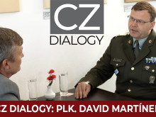
Video: Interview with the Director of the Military Geographical and Hydrometeorological Office, Colonel Vladimír Répal. / CZ DEFENCE
We are living in the era of digitalisation and various applications, so we wondered whether classic paper maps are still needed in the army. Colonel Répal is clear about this. That said, we will always strive to maintain within our office the ability to produce analogue maps. And that's either paper maps or cloth maps, which is particularly popular with the Special Forces at the moment. However, in the 21st century full of technology, the office cannot do without digitizing and producing digital geographic products," says Col. Répal.
In the context of digitisation, the Authority must then maintain sufficient capacity and information superiority capabilities to transmit high-volume dataset formats, in a time of relatively intense electromagnetic warfare. There is then a broad discussion within NATO to establish a functional system of standardisation and uniformity of geographic mapping data. "This means that the background materials should contain very similar information where it is understandably possible, for example, in exercises where weapons systems or equipment are used that have some ability to guide or use digital mapping," says the director of the Military Geographic and Hydrometeorological Office.
The Authority provides map data in the form of offline data as well as up-to-date digital map sets that are online and operated by web services. This is a huge advantage, according to Colonel Répal, because the services are not as capacity-intensive and at the same time their management, maintenance and updating is not dependent on the user, but primarily on the administrator and operator of these web services.
Today, new technologies have also changed the parameters of geographic targeting for mapping purposes. According to Colonel Répal, the change is mainly in the ability to take aerial surveying images. "Until 1989, there was only the army that could have aircraft that were capable of aerial surveying. This has changed since 1990. Today, it is done on a commercial basis," Répal explains, adding that a full flyover of the Czech republic occurs every two years. Aerial surveying is essential for creating or updating digital models of the territory, which are the main source for the creation of military maps.
The Military Geographic and Hydrometeorological Office collects detailed information not only from the Czech Republic, but also has an extensive database from around the world thanks to its many bilateral agreements with trade and alliance partners. "We are part of many working groups that are involved in the preparation, creation and implementation of various projects. The most important of these is the MGCP project, or Multinational Geospatial Co-production Program. This is a program where we exchange production with other countries, and therefore get detailed information about spaces around the world in the field of military geography. In the field of military hydrometeorology, this process is automatic because our country is part of the World Meteorological Organization and the dissemination of data and information in peacetime conditions is absolutely easy," Colonel Répal said in an interview.
In the interview we also learned that the Czech army does not use common civilian applications, it has its own. "We have de facto our own portals, GEO Portal and METEO Portal, which includes geographical and hydrometeorological data, information, products and web services of both our domains. For example, our web service, Maps of the Czech army is an absolutely perfect analogue of Google Maps or maps on Seznam," reveals the director of the Military Geographic and Hydrometeorological Office.
A new feature of maps and weather forecasts is information for the operation of unmanned aerial vehicles. "First of all, this is mapped information from registers of high-altitude objects. This means that military aerial maps that can also be used for drone security contain data that include information on all objects at airports, on high-altitude objects, on the electricity distribution network, on communication networks and so on," says Colonel Répal.
The so-called numerical model is still the basis for weather forecasting, whereas these models were previously used with lower resolution, both in time and distance. "Today, models for a limited area, such as Aladin, have a distance between two nodal points on the order of hundreds of metres or kilometres. This means that the prediction is very accurate even for model orthography. The only problem is that the numerical models on the constrained area are driven by global models, and then if the global model happens to have a sub-network scale phenomenon (a phenomenon smaller than the resolution of the numerical model), then the numerical model is understandably unable to account for it. This can happen in the case of local storms or flash floods," says Colonel Répal.
We wondered if the military meteorologist gets any feedback from his users, especially if the forecast is wrong. Colonel Répal has personal experience of this: 'At Pardubice airport I received feedback after every flight, and of course the feedback was not always excellent, and sometimes it was not without snide comments. However, I remember that time very fondly and I believe that today the feedback is not so vivid," smiles the Colonel.
In addition to the Military Geographical and Hydrometeorological Office, the chemists and artillerymen also have their own meteorologists. However, they came from the Military Geographical and Hydrometeorological Office, where many of them return. "We cooperate with them not only on the basis of regular training or regular courses, but also on the level that these meteorologists come to assist us in the aviation meteorology department at air bases or airports of the Air Force so that they not only maintain their expertise, their competence to perform the work of an aviation meteorologist-synoptic, but also to stay in touch with the Military Geographical and Meteorological Office," says Colonel Répal.
However, the Authority also provides specialised services for these departments. "They have their own chemical intelligence reports on the distribution and dispersion of poisonous or chemical substances. They are trained in chemical, biological and radiation protection conditions. However, the meteorology is the same everywhere. Gunners, in contrast to chemists, regularly measure the vertical profile of the atmosphere. This means that they have their own radiosonde measurement kits and take regular measurements to ensure the quality and support of artillery fire as part of hydrometeorological security," says Colonel Vladimir Répal, director of the Military Geographical and Hydrometeorological Office.
During the interview, we also discussed the equipment of a military meteorologist, how much of an exact science meteorology is, and how military meteorology cooperates with the Czech Meteorological Institute. For the full interview with Colonel Repal, watch the video at the beginning of this article.